Motivational Cartography
December 4, 2017 3 Comments
Sticking to long-term goals can be challenging, especially when one of them is to run a long distance race in all fifty states. The frenzied pace of the early years eventually stalls as other life commitments take priority. Plus, it never helps when one of your three remaining states is West Virginia.
But the goal is very much alive and I fully intend on getting to that last finish line. I’m still running, but I’m no longer in perennial marathon shape. I spent the summer literally changing gears by hopping on a bike and spanning the entire state of Iowa. The new sport reinvigorated my love of endurance sports and pointed me toward an inevitable triathlon in the future. I found that biking was fun in a way that running rarely is: easy, or at least much easier. When you’re used to long runs, it’s literally a breeze to bike for an hour, or even forty miles. Just like running though, if you bike long enough, you’ll eventually meet thresholds that test your heart, legs, and lungs.

Day 6/7 of RAGBRAI, 380+ miles in, still smiling
But during that time, I ran several races, and one of them was a half marathon that I didn’t write about. That oversight was part of this recent decline in running-related blog output. In fact, everything is down this year: mileage, blog posts, races, and desire to get up super early before work.
It has all extended the projected end of my 50-states goal. At one point, I thought I could be done by 2016, but then I got into the Berlin Marathon. Then the goal became 2018, but side quests into ultra-running and biking changed the nature of 2016 and 2017. At the moment, I don’t know when I’ll be done, even though I’m very, very close. In times like these, I can always use a good motivator, and I know just where to find it: in a map.
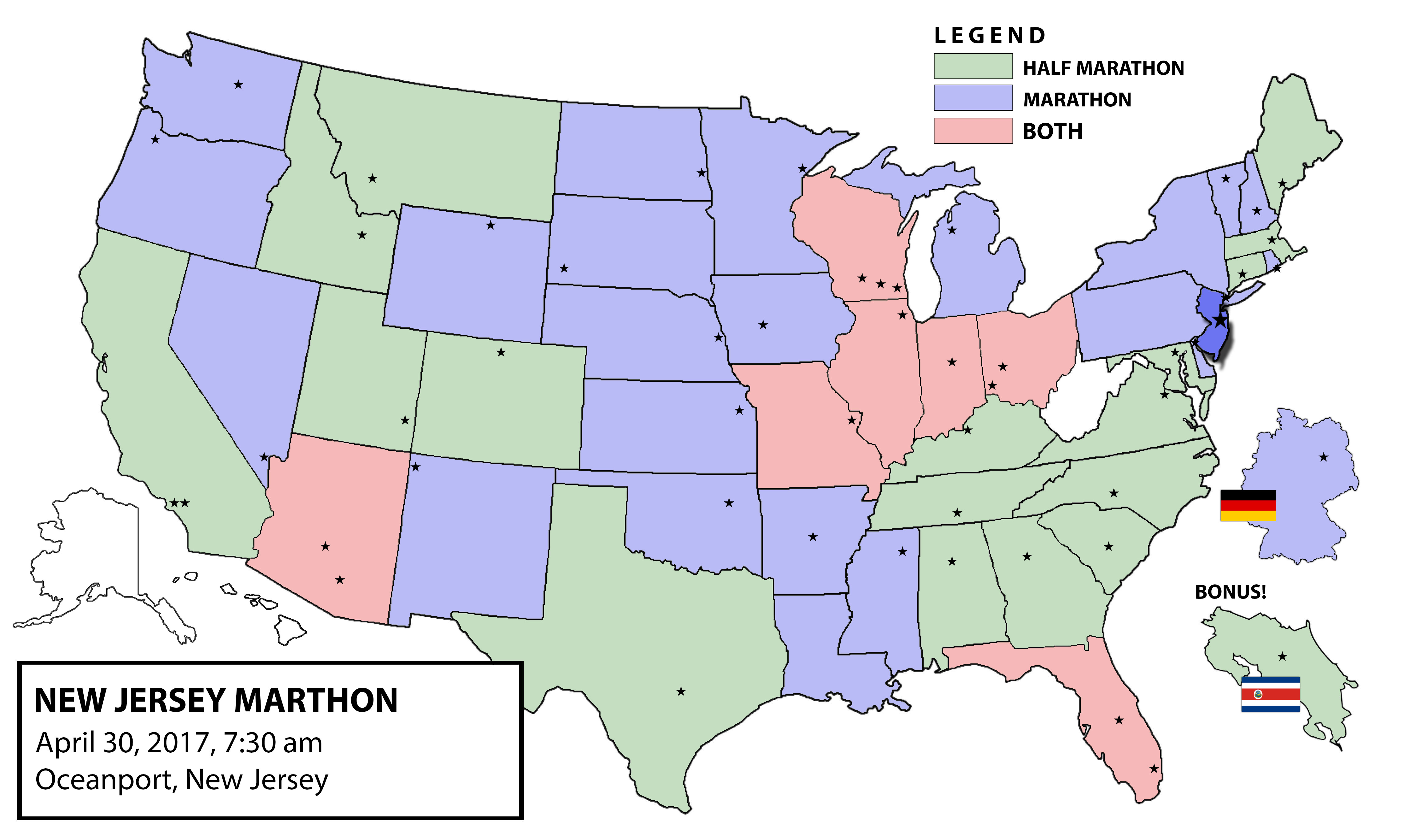
My most recent 50-states map
Readers of this space know that after every new state, I update my color-coded map with a shiny new addition. It’s a giant, lumbering Photoshop file that has far too many layers for what looks like a pretty basic map. I rarely see maps like mine because not everyone has the patience or software to make one like it.
But recently, RaceRaves solved that for everyone.
I’ve been using and doing my best to promote the site since it launched, since I really like the interface and I’ve been friends with its creators for several years. Its functionality, interface, and commitment to the running community make it one of my favorite sites for the sport. However, their latest addition to the user experience is, for diehard runners like myself, their best so far.
They make a pretty damn good map of your running adventures.

My current RaceRaves map (I have yet to write reviews for several states from 2011 and before)
Prior to this tool, map-making sites were either very rudimentary or not at all running-specific. But now thanks to the running nerds behind RaceRaves, anyone on the 50-states quest has a colorful, well-designed, and easy-to-use map of their progress. To create your own map, you list the races you’ve run, write helpful reviews of each, and watch as each state gets filled in. The map above is mine, and you’ll notice that several states aren’t filled in. This is my fault, as I haven’t reviewed all of my races on that site yet, despite earning the coveted title of Chief Lunatic.
The best part is, it doesn’t require painstakingly moving layers around in Photoshop.
So now I have two sources of motivational cartography, each showing me the scant real estate left to cover in my quest. But this is just me — if you want your own map, become a member (it’s free), add your completed races, and watch as the map fills in, with each new bright pop of color standing in for an accomplishment.


